 Polish Polar DataBase
Digital elevation model, Fuglebergsletta
Type of resources
Topics
Keywords
Contact for the resource
Provided by
Representation types
Update frequencies
status
-
%20data%20for%20Fuglebergsletta%20area.jpg)
Point cloud collected using the Riegl VZ®-6000 long-range terrestrial laser scanner. The TLS survey was carried out on 15th August 2021. The dataset is the result of relative and absolute registration of four point clouds. The dataset is the supplement to the paper: Błaszczyk, M.; Laska, M.; Sivertsen, A.; Jawak, S.D. Combined Use of Aerial Photogrammetry and Terrestrial Laser Scanning for Detecting Geomorphological Changes in Hornsund, Svalbard. Remote Sens. 2022, 14, 601. https://doi.org/10.3390/rs14030601
-
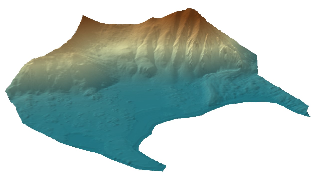
Digital elevation model (DEM) combined from DEM derived from aerial images captured in 2020 over Hornsund, Svalbard by Dornier aircraft and from terrestrial laser scanner campaign in 2021. Both DEMs contain data gaps; therefore, they were combined to create a continuous product with the best possible accuracy and resolution. The dataset is the supplement to the paper: Błaszczyk, M.; Laska, M.; Sivertsen, A.; Jawak, S.D. Combined Use of Aerial Photogrammetry and Terrestrial Laser Scanning for Detecting Geomorphological Changes in Hornsund, Svalbard. Remote Sens. 2022, 14, 601. https://doi.org/10.3390/rs14030601